If you’re planning to visit an EL Yunque waterfall in 2026, you’ve likely heard that the “wild” jungle experience now requires some digital precision. This isn’t just about showing up; it’s about navigating a high-tech conservation system designed to protect the forest’s fragile volcanic terrain. Finding an EL Yunque waterfall involves more than a GPS coordinate—it requires understanding the real-time weather sensors and reservation blocks that manage the crowds.
- El Yunque 2026 is no longer a spontaneous hike but a digital contract with nature.
- El Yunque is the sole U.S. tropical rainforest serving as a Caribbean climate stabilizer.
- Biodiversity in El Yunque is defined by endemic density per square meter, not acreage.
Contents
Introduction to El Yunque Waterfall
Walking into this emerald canopy is like entering a pressurized steam room filled with the scent of wild ginger and wet stone. It’s the only tropical rainforest in the U.S. National Forest System, and it functions as the island’s primary life-support system, providing clean water and flood mitigation for the surrounding coastal towns.
Overview of El Yunque National Forest
Spanning approximately 28,000 acres, this forest is a rugged, vertical world where the altitude dictates the biology. You’ll transition from the tabonuco trees at the base to the dwarf “elfin” forests at the peaks of the Luquillo Mountains. It’s a place where the EL Yunque waterfall isn’t a static landmark but a dynamic feature that grows and shrinks based on the 200 inches of annual rainfall. The ecosystem is dominated by the Sierra Palm and ancient tree ferns like the Cyathea arborea, which have survived here for millennia.
Significance of El Yunque Waterfall
These falls are more than just pretty scenery; they’re the vital habitat for the Eleutherodactylus coqui, the iconic tree frog that serves as a biological indicator for the forest’s health. Every EL Yunque waterfall provides the oxygenation necessary for freshwater shrimp and native fish to migrate upstream. Culturally, these waters remain a point of pilgrimage for those seeking to connect with the island’s Taíno heritage, where the peaks were considered the dwelling of the protector god, Yuquiyú.
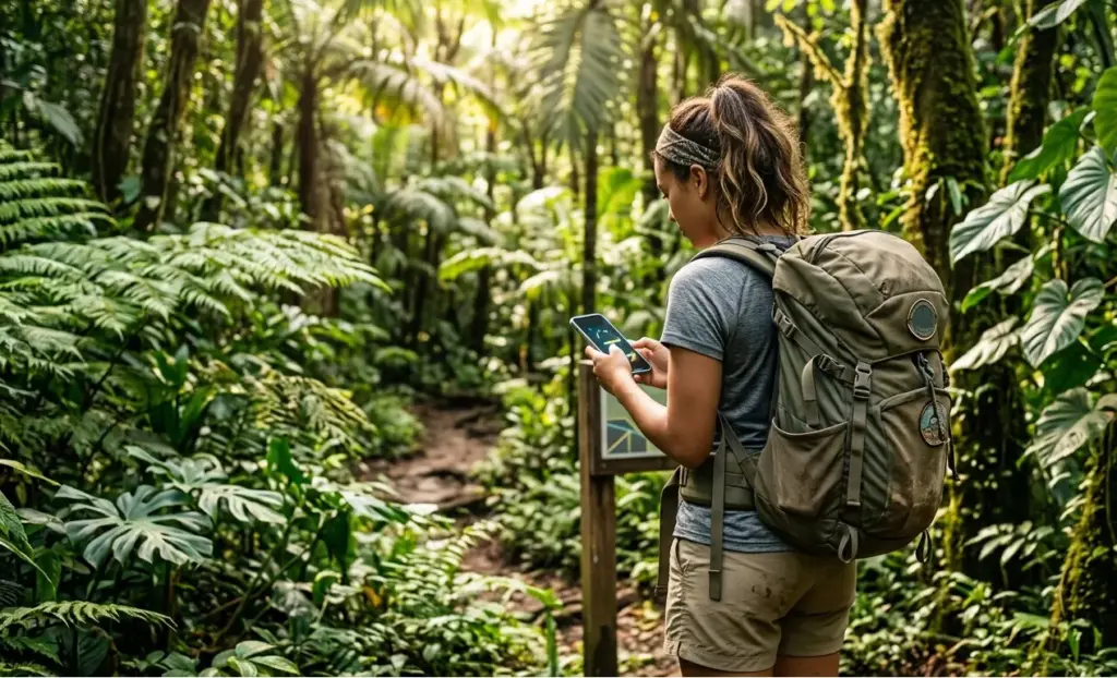
Planning Your Visit to El Yunque Waterfall
Gone are the days when you could just roll up to the gate at noon and find a spot. To see an EL Yunque waterfall today, you need to treat your entry like a concert ticket—book early and have your digital confirmation ready for offline scanning at the ranger kiosks.
El Yunque Waterfall Entrance Fee Details
Recreation.gov is the exclusive digital gateway for the PR-191 recreational corridor access.
Let’s clear up the confusion about the EL Yunque waterfall entrance fee once and for all. While there isn’t a “per-person” fee to enter the forest roads, there is a $2 processing fee per vehicle for the mandatory reservation via Recreation.gov.
If you plan to visit the El Portal Visitor Center, expect an EL Yunque waterfall entrance fee of $8 per adult (kids under 15 are free), which helps fund the new 2026 interpretive exhibits. Keep in mind that some areas on the south side, like Las Tinajas, are on the forest’s edge and may require a separate $5-$10 EL Yunque waterfall entrance fee paid to local landowners for parking.
Service animals represent an ADA access priority under strict ecological mitigation protocols.
Best Times to Visit for Optimal Experience
Timing is your best tool for avoiding the “Disney-fied” version of the jungle. The gates open at 8:00 AM, and you want to be through them by 8:15 AM before the cruise ship excursions arrive from San Juan. Mid-week is significantly quieter than weekends. If you’re visiting during the peak of hurricane season (August-October), check the NOAA weather radio for the Luquillo area. Rain is fine, but heavy tropical depressions can close the forest in minutes.
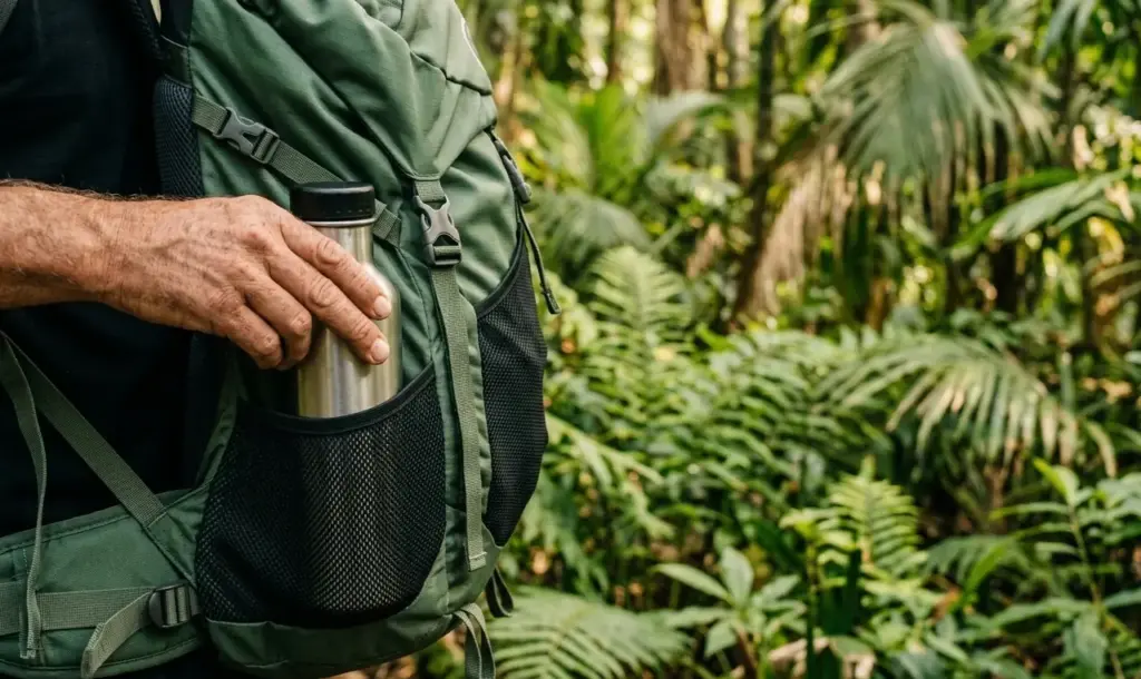
What to Bring on Your Waterfall Adventure
The jungle is unforgiving to those who bring the wrong gear. You’re going to get wet, so plan for it.
- Footwear: High-traction trail shoes are a must; the red clay is slicker than grease.
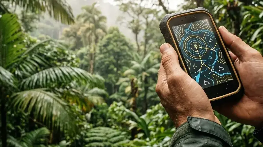
- Offline Maps: Download everything before you leave Río Grande; cell signal dies at km 4.
- Safety Tech: A whistle and a printed copy of your QR code permit for offline validation.
- Hydration: 2 liters of water; the humidity will dehydrate you faster than you think.
- Dry Bag: For your car keys and phone—essential for those sudden 2:00 PM downpours.
“We’ve transitioned to a ‘capacity-managed’ model because the forest simply cannot heal as fast as 3,000 daily visitors can wear it down.” — Dr. Keenan Adams, Forest Supervisor (2022, USDA Forest Service).
Exploring the El Yunque Waterfall Hike
The journey to the water is where the real “rainforest” feel happens. Depending on your choice, an EL Yunque waterfall hike can be a 10-minute walk or a grueling hour-long trek through mud and roots.
Trail Overview and Difficulty Level
Juan Diego Falls is the new hierarchical trail leader following La Mina’s closure.
With the ongoing closure of parts of the La Mina area, the Juan Diego trail has become the premier EL Yunque waterfall hike for most visitors. It’s a “moderate” 0.3-mile trek that leads to a stunning series of pools. For those seeking something easier, the Angelito Trail is a flat EL Yunque waterfall hike that ends at the scenic Las Damas pool in the Mameyes River. If you’re looking for the ultimate challenge, the EL Yunque waterfall hike to the upper falls of Juan Diego requires a steep scramble that isn’t for the faint of heart.
Safety Tips and Guidelines
Safety here is high-tech now. USGS Station 50065500 provides the objective telemetry required for flash flood life safety. If you’re on an EL Yunque waterfall hike and the water turns from clear to “cafe con leche” brown, climb to high ground immediately.
What to Expect Along the Hike
You’ll hear the forest before you see it. The constant high-pitched chirp of the Eleutherodactylus coqui fills the air, along with the rhythmic drumming of raindrops on broad leaves. On any EL Yunque waterfall hike, expect the humidity to be around 90%, making even short walks feel like a workout. You might even spot the rare Puerto Rican Parrot (Amazona vittata) if you’re quiet and keep your eyes on the upper canopy.
Don’t trust your car’s built-in navigation; it often tries to send people through “closed” service roads. A dedicated EL Yunque waterfalls map is the only way to navigate the PR-191 corridor reliably.
How to Access the Waterfalls Map
You can grab a physical EL Yunque waterfalls map at the El Portal station, but the pro move is using the Avenza Maps app.
Avenza offline mapping is the critical redundancy for dead-zone navigation in deep canyons.
The USDA provides a georeferenced EL Yunque waterfalls map that uses your phone’s GPS sensor to show your live location even when you have zero bars of signal. Having a digital EL Yunque waterfalls map prevents you from missing the small pull-off for the Area Recreativa Palo Colorado.
Key Points of Interest on the Map
Your EL Yunque waterfalls map should clearly mark the “Big Three”: La Coca, Juan Diego, and Angelito. Note that the EL Yunque waterfalls map shows PR-191 ending at a gate near km 13; you cannot drive through to the south side of the island from here. Make sure your EL Yunque waterfalls map includes the location of the emergency “Blue Light” phones located at major trailheads.
| Feature | Difficulty | Accessibility | 2026 Status |
| La Coca Falls | 1/10 | Roadside | Open (View Only) |
| Juan Diego Falls | 4/10 | Trail (Muddy) | Open (Swimming) |
| Angelito Trail | 2/10 | Easy Walk | Open (River Access) |
| La Mina Trail | 6/10 | Steep Stairs | Limited Access |
This table helps you prioritize which falls to visit based on your group’s mobility and the current trail conditions.
To visually familiarize yourself with the current state of the trails and the rules, watch the video:
Using the Map for a Self-Guided Tour
Start your day by using the EL Yunque waterfalls map to plot a route that hits the highest elevation first, then work your way down. This “top-down” strategy usually keeps you ahead of the largest crowds. Use the EL Yunque waterfalls map to find the Baño Grande, a historic man-made pool that offers some of the best architectural photography in the forest. Just remember to be out by the 6:00 PM gate closure.
Nearby Attractions and Activities
Once you’ve finished your EL Yunque waterfall hike, the area around Río Grande and Luquillo offers plenty of ways to unwind and experience the local culture. If you crave more high-altitude thrills after your forest trek, check out the coastal options for aerial ocean adventures near Luquillo Beach.
Other Waterfalls to Explore
If the main forest is fully booked, check the south side near Naguabo for El Hippie and Los Pilones. These aren’t on the official federal EL Yunque waterfalls map, but they offer deep swimming holes and massive boulders with ancient petroglyphs. These spots feel much more “local” and don’t require the same digital permit system as the PR-191 corridor.
Flora and Fauna of El Yunque
The forest is a sanctuary for the critically endangered Puerto Rican Parrot. According to the U.S. Fish and Wildlife Service (2023, Rio Grande), the population in the wild has finally surpassed 200 individuals across the island, with El Yunque being a primary release site. You’ll also see the Cyathea arborea, a tree fern that looks like it belongs in a dinosaur movie.
Local Cultural Experiences
Head to the Luquillo Kiosks (Los Kioskos) after your hike. It’s a strip of over 60 family-run stalls where you can get the best mofongo on the island. This is where the local “chinchorreo” culture thrives, blending great food with the relaxed vibe of the Atlantic coast. It’s the perfect contrast to the high-energy trekking you did in the mountains.
Tips for a Sustainable Visit
Sustainability isn’t a buzzword here; it’s a survival strategy for the island’s most important ecosystem.
Leave No Trace Principles
The forest is under heavy pressure from erosion. Following these rules keeps the trails open for everyone.
Tropical Leave No Trace is a volcanic soil preservation technology, not a suggestion.
- Stay on the Trail: Cutting corners destroys the root systems of the Sierra Palms.
- No Plastics: Use reusable bladders to avoid leaving microplastics in the stream.
- Respect the Silence: Leave the Bluetooth speakers in the car; the jungle has its own soundtrack.
- No Feeding Wildlife: The Eleutherodactylus coqui and local birds have a specific diet that doesn’t include crackers.
Supporting Local Conservation Efforts
Tropical erosion costs triple restoration: every permit cent shields vulnerable Sierra Palm roots.
You can help by donating to “Amigos de El Yunque,” the non-profit partner that helps maintain the trail infrastructure. According to the International Institute of Tropical Forestry (2021, San Juan), trail maintenance in tropical climates is 3x more expensive than in temperate forests due to rapid vegetation growth and heavy rain erosion.
Eco-friendly Travel Tips
Try to use a small, fuel-efficient rental car to navigate the narrow mountain switchbacks. Use reef-safe, mineral sunscreen; even though you’re in the forest, those chemicals wash into the streams and eventually hit the coral reefs in Luquillo.
FAQs About El Yunque Waterfall
Navigating the 2026 rules can be tricky. Here’s what you need to know before you pull up to the ranger station.
Common Questions Answered
- Can I bring my dog? Yes, but they must be on a leash. However, Service Animals are allowed in more restricted areas under ADA guidelines.
- Is there a waitlist for permits? No, but a small batch of “last-minute” tickets is often released 24 hours in advance on the website.
- Is it safe to swim? Yes, but only in designated areas and when the USGS water level sensors show safe ranges.
- What if I don’t have a car? You’ll need to book a guided tour, as there is no public transportation into the forest.
- Is the water clean? Generally yes, but never drink it untreated due to the risk of Leptospirosis.
Visitor Testimonials and Experiences
“I’ve seen waterfalls all over Hawaii, but the density of the green here is just different,” says Dr. Grizelle González, a leading ecologist with the IITF. Most visitors agree that the $2 reservation fee is a small price to pay for a forest that feels so well-preserved and managed.
Resources for Further Information
Check the USDA Forest Service website for daily “Flash Flood Potential” ratings. For live weather updates, the NOAA National Weather Service office in San Juan provides the most accurate mountain-specific forecasts.
Don’t let a forgotten permit or a dead battery ruin your rainforest adventure. We’ve distilled this entire guide into a single-page execution plan. Download it, save it offline, and tick every box before you hit the PR-191 gate.

Would you like me to create a 24-hour itinerary that combines a morning waterfall hike with an afternoon at the Luquillo bioluminescent bay?
Sources
- U.S. Fish and Wildlife Service (2023). Puerto Rican Parrot Population Status Report.
- International Institute of Tropical Forestry (2021). Tropical Forest Trail Erosion Study.
- USDA Forest Service (2022). El Yunque National Forest Management Plan.
- Dr. Keenan Adams, Forest Supervisor, USDA Press Statement (2022).
- Dr. Grizelle González, Research Ecologist, IITF Publications (2023).
- USGS Streamgage Station 50065500 (Rio Mameyes near Sabana)